In an increasingly data-rich world, geospatial information has emerged as a critical asset, influencing everything from urban planning and environmental conservation to logistics and disaster response. As of mid-2025, the sheer volume and complexity of location-based datasets are escalating, presenting both immense opportunities and significant challenges. Traditional methods of geospatial analysis, while foundational, often struggle to keep pace with this deluge of information, limiting the depth of insights and the speed of decision-making. Enter Artificial Intelligence (AI) – a transformative force poised to revolutionize how we interpret and utilize spatial data.
This comprehensive guide is tailored specifically for Python developers eager to bridge the gap between cutting-edge AI techniques and the intricate world of geographical information systems (GIS). We will explore the practical applications of AI in enhancing geospatial data interpretation and decision-making, demonstrating how to implement powerful machine learning models using Python libraries specifically designed for geospatial analysis. By integrating AI with Python, developers can unlock unparalleled efficiencies, uncover hidden patterns, and derive profound insights from complex location-based datasets. Prepare to elevate your geospatial projects and embrace the future of data-driven intelligence.
The Convergence of AI and Geospatial Data
The synergy between Artificial Intelligence and geospatial data has never been more profound. Why now, in 2025? The answer lies in several concurrent advancements: the exponential growth in diverse geospatial data sources (high-resolution satellite imagery, drone data, IoT sensor networks, mobile device locations), coupled with significant leaps in AI algorithms and computational power. This convergence facilitates what we now term AI-driven geospatial analysis, moving beyond mere mapping to predictive modeling, automated feature extraction, and intelligent decision support systems.
What is AI-driven geospatial analysis? At its core, it involves applying machine learning (ML), deep learning (DL), and other AI techniques to spatial and spatio-temporal datasets to extract meaningful patterns, make predictions, and automate complex analytical tasks. This paradigm shift offers immense benefits, including enhanced accuracy in classifications, automation of tedious manual processes, superior predictive capabilities for future events, and sophisticated pattern recognition that human analysts might overlook. The real-world impact is already evident: from optimized urban planning and precise environmental monitoring to efficient logistics and rapid disaster response, AI is reshaping how we interact with our world's geography.
Setting Up Your AI Geospatial Environment in Python
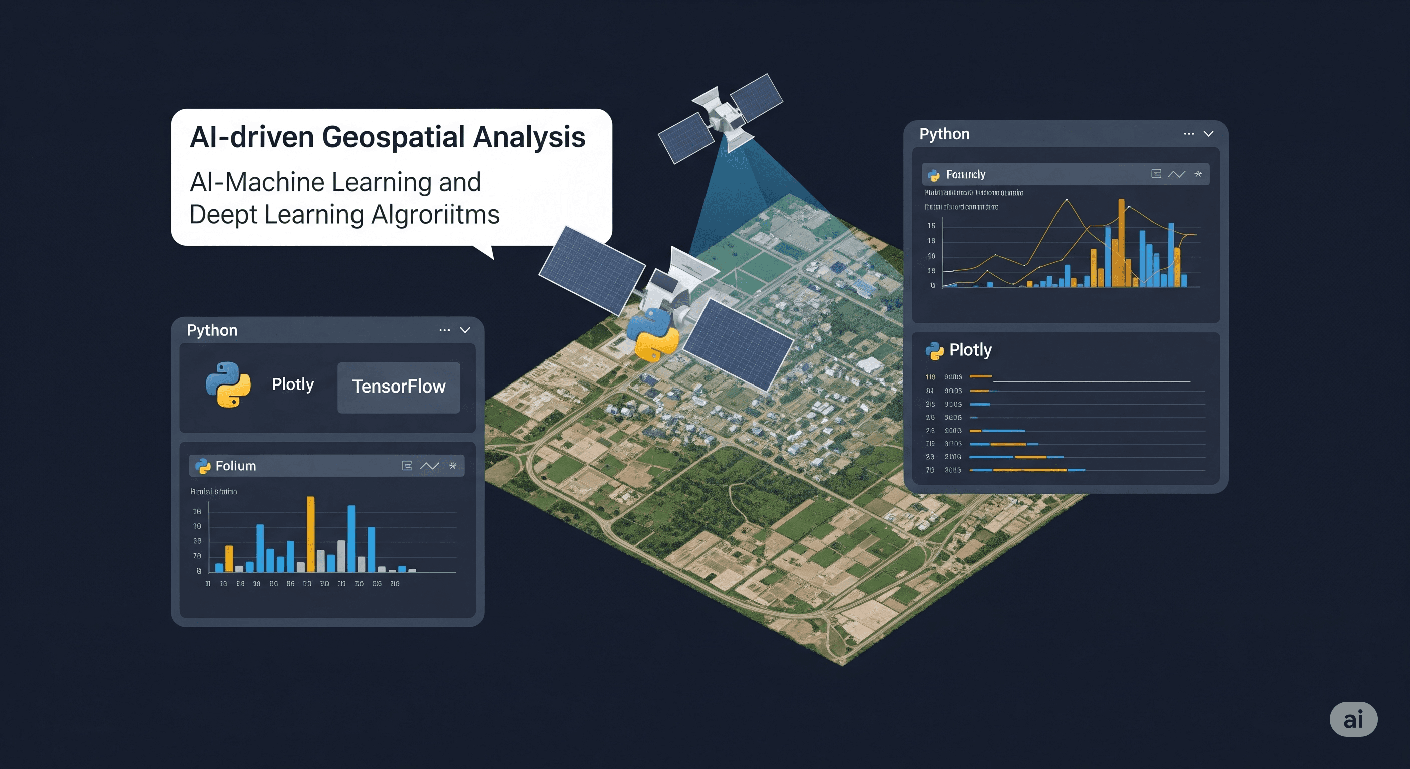
Python's versatility and its rich ecosystem of libraries make it the undisputed champion for geospatial data analysis with AI. Before diving into advanced applications, setting up a robust development environment is crucial. Here are the essential Python geospatial libraries you'll need, along with core machine learning tools:
Essential Python Libraries for Geospatial Analysis
- GeoPandas: This foundational library extends the popular Pandas data structures to allow spatial operations on geometric types. It's indispensable for working with vector data (points, lines, polygons) and seamlessly integrates with other geospatial libraries, making it easy to perform spatial joins, overlays, and re-projections.
- Shapely, Fiona, PyPROJ: These are often dependencies for GeoPandas but are critical in their own right. Shapely provides geometric objects and operations, Fiona handles reading and writing various geospatial file formats, and PyPROJ manages coordinate reference system (CRS) transformations.
- Rasterio: When dealing with raster data – such as satellite imagery, digital elevation models (DEMs), or climate grids – Rasterio is your go-to. It provides a clean, Pythonic interface for reading, writing, and manipulating raster files.
- Folium / Leaflet: For interactive map visualizations directly within your Jupyter notebooks or web applications, Folium (a Python wrapper for Leaflet.js) is excellent. It allows you to overlay your analyzed data on interactive web maps, providing immediate visual feedback.
- Scikit-learn: While not specifically geospatial, Scikit-learn is the cornerstone for traditional machine learning algorithms. It offers a wide range of tools for classification, regression, clustering, and dimensionality reduction, all applicable to geospatial features.
- TensorFlow / PyTorch: For deep learning applications in GIS, particularly for image classification, object detection on satellite imagery, or semantic segmentation, TensorFlow and PyTorch are the leading frameworks. They provide the power to build and train complex neural networks.
- Rtree / GDAL: Rtree provides a spatial index for fast nearest-neighbor searches and spatial queries, crucial for optimizing performance with large datasets. GDAL (Geospatial Data Abstraction Library) is the underlying power tool for many of these libraries, offering low-level data format support and processing capabilities.
Installation: Most of these libraries can be installed via pip or, more robustly, via conda for environment management:
pip install geopandas rasterio scikit-learn tensorflow foliumOr, using conda:
conda install -c conda-forge geopandas rasterio scikit-learn tensorflow foliumEnsure your environment is set up correctly to avoid common dependency conflicts, especially when mixing geospatial and deep learning packages.
Machine Learning in GIS: Practical Applications
Machine learning in GIS is transforming how we approach complex spatial problems. Here are some of the most impactful practical applications of AI-driven geospatial analysis in 2025:
Image Classification and Object Detection
Satellite and aerial imagery are invaluable data sources. AI, particularly deep learning with Convolutional Neural Networks (CNNs), excels at analyzing these images. Applications include:
- Land Cover Classification: Automatically classifying land types (forests, water bodies, urban areas, agriculture) from satellite imagery, crucial for environmental monitoring, urban planning, and climate change studies.
- Urban Sprawl Detection: Identifying and quantifying the expansion of urban areas over time, vital for sustainable development.
- Object Detection: Automatically pinpointing specific features like buildings, vehicles, infrastructure, or even specific crop types within imagery for asset management, surveillance, or agricultural monitoring.
Predictive Modeling for Spatial Phenomena
AI's ability to learn from historical data enables powerful predictive capabilities for spatial events:
- Crime Hot-spot Prediction: Identifying areas prone to specific types of crime based on historical data, demographics, and spatial relationships, aiding law enforcement in resource allocation.
- Disease Outbreak Forecasting: Predicting the spread of diseases by analyzing demographic data, population movement, environmental factors, and existing infection clusters.
- Traffic Congestion Forecasting: Using real-time and historical traffic data, weather, and events to predict future congestion, optimizing routes and informing urban traffic management.
- Natural Disaster Risk Assessment: Predicting areas most vulnerable to floods, wildfires, or landslides based on topography, land cover, weather patterns, and historical events.
Clustering and Anomaly Detection
Unsupervised learning techniques are excellent for uncovering hidden patterns and unusual occurrences in geospatial datasets:
- Customer Segmentation (Location-Based): Identifying clusters of customers with similar purchasing behaviors or demographics based on their geographical distribution for targeted marketing.
- Environmental Contamination Source Identification: Pinpointing potential sources of pollution by analyzing spatial patterns in contamination data.
- Fraud Detection: Identifying unusual patterns in financial transactions or insurance claims based on geographic outliers.
Natural Language Processing (NLP) with Location Data
An emerging and increasingly vital trend in 2025 is the integration of NLP with geospatial data. This involves:
- Geocoding Unstructured Text: Extracting location names from text (e.g., social media posts, news articles, customer reviews) and converting them into precise geographic coordinates.
- Sentiment Analysis with Spatial Context: Analyzing the sentiment expressed in location-tagged social media data to understand public opinion about specific places, events, or policies.
Implementing AI Models for Geospatial Insights
To effectively leverage AI for geospatial data interpretation, a structured approach to data preparation, model selection, and code organization is paramount. This section will guide Python developers through the practical steps.
Data Preparation is Key
The success of any AI model hinges on the quality and preparation of your data. For geospatial analysis, this involves several unique considerations:
- Data Acquisition: Source your data responsibly. Options include open datasets (OpenStreetMap, national geodata portals like USGS Earth Explorer, NOAA), commercial satellite imagery APIs, IoT sensor feeds, and public record databases. Ensure you understand licensing and usage terms.
- Preprocessing: This is often the most time-consuming step. It includes:
- Cleaning: Handling missing values, correcting inaccuracies, and removing outliers.
- Projection Transformation: Ensuring all your datasets are in a consistent Coordinate Reference System (CRS) is critical (geopandas.to_crs()). Incompatible CRSs can lead to misalignments and erroneous results.
- Feature Engineering: Creating new, meaningful features from your raw geospatial data. This might include calculating distances to points of interest, population density, slope from a DEM, connectivity measures, or buffer zones around features. These spatial features can significantly improve model performance.
- Handling Imbalanced Geospatial Datasets: In real-world scenarios, classes might be unevenly distributed (e.g., very few flood events compared to non-flood areas). Techniques like oversampling (SMOTE), undersampling, or using specific loss functions can mitigate this.
Choosing the Right AI Model
The choice of AI model depends on your problem type and data characteristics:
- Supervised Learning: For tasks where you have labeled training data (e.g., image classification, predicting a continuous value like temperature).
- Random Forests / Gradient Boosting Machines (XGBoost, LightGBM): Excellent for tabular geospatial data, robust to outliers, and provide feature importance scores.
- Support Vector Machines (SVMs): Effective for classification and regression tasks, particularly when data is not linearly separable.
- Neural Networks (Deep Learning): Essential for complex tasks like image segmentation, object detection, or when dealing with very large, high-dimensional datasets. Use CNNs for raster data and Graph Neural Networks (GNNs) for network analysis (e.g., transportation networks).
- Unsupervised Learning: For tasks where you want to find patterns or groupings in unlabeled data (e.g., clustering, anomaly detection).
- K-means / DBSCAN: For identifying spatial clusters of points or regions.
- Principal Component Analysis (PCA): For dimensionality reduction of high-dimensional geospatial features.
Considerations:
- Data Type: Vector data (points, lines, polygons) often pairs well with traditional ML algorithms and graph-based approaches. Raster data (images) typically requires deep learning (CNNs).
- Problem Type: Is it classification, regression, clustering, or a more complex task like segmentation?
- Computational Resources: Deep learning models can be computationally intensive, requiring GPUs for efficient training.
- Interpretability: Some models (e.g., linear regression, decision trees) are more interpretable than complex deep neural networks. Consider Explainable AI (XAI) techniques if model transparency is crucial.
Code Structure for Optimal Performance
Well-structured code is crucial for maintainability, readability, and performance, especially in complex AI-driven geospatial analysis projects. Here are best practices for Python developers:
- Modularize Your Code: Break down your project into logical functions and modules. For instance, separate functions for data loading, preprocessing, feature engineering, model training, prediction, and visualization. This enhances reusability and makes debugging easier.
- Efficient Data Handling: Geospatial datasets can be enormous. Avoid loading entire datasets into memory if not necessary. Consider using libraries like Dask-GeoPandas for out-of-core processing of large vector files or Xarray for large raster datasets. Explore parallel processing techniques (e.g., joblib, multiprocessing) for computationally intensive tasks.
- Vectorization over Loops: Whenever possible, use vectorized operations provided by NumPy, Pandas, or GeoPandas instead of explicit Python loops, as they are significantly faster.
- Version Control: Use Git for version control to track changes, collaborate with others, and easily revert to previous states.
- Reproducibility: Document your data sources, preprocessing steps, model parameters, and environment dependencies (e.g., requirements.txt or environment.yml) to ensure your analysis can be reproduced by others.
# Conceptual Example: Classifying Countries by Economic Development Level
# using GeoPandas and a Scikit-learn Classifier

import geopandas as gpd
import pandas as pd
from sklearn.model_selection import train_test_split
from sklearn.ensemble import RandomForestClassifier
from sklearn.metrics import classification_report, accuracy_score
import folium
import numpy as np # For potential numeric operations, though not heavily used here

print("--- Starting Conceptual Example: Classifying Countries ---")

# 1. Data Loading
# We'll use the built-in naturalearth_lowres dataset from GeoPandas.
# This dataset contains country polygons with attributes like population and GDP.
print("1. Loading geospatial data (naturalearth_lowres)...")
gdf = gpd.read_file(gpd.datasets.get_path('naturalearth_lowres'))

# Filter out Antarctica for better visualization and common analysis
gdf = gdf[gdf['continent'] != 'Antarctica'].copy()
print(f"Loaded {len(gdf)} countries (excluding Antarctica).")

# 2. Feature Engineering
# Create new, relevant features from the raw geospatial data.
# These will serve as input for our AI model.
print("2. Engineering features for the AI model...")

# Calculate area in square kilometers
# GeoPandas geometries have an 'area' attribute; divide by 10^6 for km^2
gdf['area_sq_km'] = gdf.geometry.area / (10**6)

# Extract centroid coordinates as numerical features (spatial features)
# These represent the 'location' of each country for the model.
gdf['centroid_latitude'] = gdf.geometry.centroid.y
gdf['centroid_longitude'] = gdf.geometry.centroid.x

# Ensure population and GDP are numeric and handle potential NaNs
# Real-world data often needs careful NaN handling (e.g., imputation or removal)
gdf['pop_est'] = pd.to_numeric(gdf['pop_est'], errors='coerce')
gdf['gdp_md_est'] = pd.to_numeric(gdf['gdp_md_est'], errors='coerce')

# 3. Data Preparation for Machine Learning (Classification Task)
# We need input features (X) and a target variable (y).
# For demonstration, we'll create a synthetic 'economic_level' target based on GDP.
print("3. Preparing data for Machine Learning...")

# Create a 'economic_level' target variable based on GDP.
# This simulates having a categorical label for each country.
# In a real project, this target would come from actual economic classifications.
gdp_bins = pd.qcut(gdf['gdp_md_est'], q=3, labels=['Low_Income', 'Middle_Income', 'High_Income'], duplicates='drop')
gdf['economic_level'] = gdp_bins.astype(str) # Convert to string to avoid Categorical warnings later

# Define our features (X) and the target variable (y)
input_features = ['pop_est', 'gdp_md_est', 'area_sq_km', 'centroid_latitude', 'centroid_longitude']
target_variable = 'economic_level'

X = gdf[input_features].copy()
y = gdf[target_variable].copy()

# Handle missing values in features by filling with the mean.
# This is a simple strategy; more advanced methods exist.
X = X.fillna(X.mean())

# Convert the categorical target variable into numerical codes for Scikit-learn
# Store the mapping to interpret results later.
economic_categories = y.astype('category').cat.categories
y_encoded = y.astype('category').cat.codes
category_mapping = dict(enumerate(economic_categories))
print(f"Economic level categories (encoded): {category_mapping}")

# Split data into training and testing sets
X_train, X_test, y_train, y_test = train_test_split(X, y_encoded, test_size=0.3, random_state=42, stratify=y_encoded)
print(f"Training data shape (X_train): {X_train.shape}")
print(f"Testing data shape (X_test): {X_test.shape}")

# 4. Model Training
# We'll use a RandomForestClassifier, a robust and widely used algorithm.
print("4. Training RandomForestClassifier model...")
model = RandomForestClassifier(n_estimators=100, random_state=42, class_weight='balanced')
model.fit(X_train, y_train)
print("Model training complete.")

# 5. Prediction and Evaluation
print("5. Making predictions and evaluating the model...")
y_pred_encoded = model.predict(X_test)

# Convert predictions back to original labels for readability
y_pred_labels = [category_mapping[code] for code in y_pred_encoded]
y_test_labels = [category_mapping[code] for code in y_test]

print("\nClassification Report on Test Data:")
print(classification_report(y_test_labels, y_pred_labels))
print(f"Overall Accuracy: {accuracy_score(y_test_labels, y_pred_labels):.2f}")

# To visualize on the map, we need predictions for the *entire* GeoDataFrame
gdf_with_predictions = gdf.copy()
# Ensure X for prediction has the same columns and fillna strategy as training
X_full_data = gdf_with_predictions[input_features].fillna(X.mean())
gdf_with_predictions['predicted_economic_level_encoded'] = model.predict(X_full_data)
gdf_with_predictions['predicted_economic_level'] = gdf_with_predictions['predicted_economic_level_encoded'].map(category_mapping)

print("Predictions for full dataset generated for visualization.")

# 6. Visualization using Folium
print("6. Generating interactive map visualization with predicted levels...")

# Define a color mapping for economic levels for visualization
level_colors = {
    'Low_Income': '#FF5733',    # Reddish
    'Middle_Income': '#FFC300', # Orangish
    'High_Income': '#33FF57'    # Greenish
}

# Create a base map centered roughly on the world
m = folium.Map(location=[20, 0], zoom_start=2, tiles="CartoDB positron")

# Add the predicted economic levels as a choropleth map layer
def style_function(feature):
    predicted_level = feature['properties']['predicted_economic_level']
    color = level_colors.get(predicted_level, 'grey') # Default to grey if category not found
    return {
        'fillOpacity': 0.7,
        'weight': 0.5,
        'color': 'black',
        'fillColor': color
    }

folium.GeoJson(
    gdf_with_predictions,
    name='Predicted Economic Level',
    style_function=style_function,
    tooltip=folium.GeoJsonTooltip(fields=['name', 'predicted_economic_level', 'gdp_md_est', 'pop_est'],
                                  aliases=['Country', 'Predicted Level', 'GDP (M USD)', 'Population Est.'])
).add_to(m)

# Add a layer control to toggle layers on the map
folium.LayerControl().add_to(m)

# Display the map (uncomment if running in a Jupyter Notebook)
# m

# Optional: Save the map to an HTML file
# m.save("predicted_economic_level_map.html")
# print("Map saved as predicted_economic_level_map.html")

print("\n--- Conceptual Example Complete ---")
print("This example demonstrates how AI can classify geospatial entities (countries) based on their attributes, including spatial ones (centroids), and visualize the results on an interactive map.")
Challenges and Future Trends in AI Geospatial
While the promise of AI-driven geospatial analysis is immense, it's essential for Python developers to be aware of the challenges and stay ahead of emerging trends as of mid-2025.
Challenges
- Data Privacy and Ethics: Handling sensitive location data raises significant privacy concerns. Ensuring compliance with regulations like GDPR and developing ethical AI models that avoid bias is paramount.
- Computational Requirements: Processing and analyzing vast, high-resolution geospatial datasets with complex AI models demands significant computational power, often requiring cloud computing resources or specialized hardware (GPUs).
- Model Interpretability: Complex deep learning models can act as "black boxes," making it difficult to understand why a particular prediction was made. This lack of transparency can be a barrier in critical applications like disaster management or public safety. The field of Explainable AI (XAI) is actively addressing this.
- Data Quality and Standardization: Geospatial data often comes from disparate sources with varying quality, formats, and projections. Standardizing and cleaning this data is a continuous challenge.
- Dynamic Data: Real-time geospatial data streams (e.g., traffic, weather, social media) require models that can adapt and learn continuously.
Emerging Trends for 2025 and Beyond
- Edge AI for Real-time Processing: Deploying AI models directly on IoT devices or sensors (e.g., drones, autonomous vehicles) to perform immediate geospatial analysis without sending data to the cloud, crucial for real-time decision-making.
- Explainable AI (XAI) in GIS: As mentioned, XAI techniques are becoming more sophisticated, allowing developers to gain insights into the decision-making process of complex geospatial AI models, fostering trust and accountability.
- Federated Learning for Distributed Geospatial Data: A privacy-preserving approach where AI models are trained on decentralized datasets (e.g., across different organizations or devices) without sharing the raw data. This is particularly relevant for sensitive location information.
- Digital Twins and AI Integration: The creation of virtual replicas of physical assets or systems (Digital Twins) is rapidly expanding. Integrating AI-driven geospatial analysis with Digital Twins will enable highly accurate simulations, predictive maintenance, and optimized urban management.
- Quantum Computing's Potential Impact: While still largely in the research phase, quantum computing holds long-term promise for solving highly complex optimization and pattern recognition problems in geospatial analysis that are intractable for classical computers.
Conclusion
The integration of AI into geospatial analysis marks a pivotal shift in how we understand and interact with our world. For Python developers, this convergence presents an incredibly exciting and fertile ground for innovation. From automating mundane tasks to unveiling previously unimaginable insights, AI-driven geospatial analysis empowers us to make smarter, more informed decisions across a myriad of domains.
By mastering the essential Python geospatial libraries, understanding the nuances of machine learning in GIS, and adopting robust coding practices, you can unlock the full potential of location-based data. The field is rapidly evolving, with new models, datasets, and applications emerging constantly. Embrace this journey of continuous learning, experiment with the tools and techniques discussed, and contribute to shaping the future of spatial intelligence. The opportunities for geospatial data interpretation enhanced by AI are limitless, and Python developers are at the forefront of this revolution.
FAQ Section
What is AI-driven geospatial analysis?
AI-driven geospatial analysis involves applying artificial intelligence (AI) techniques, such as machine learning and deep learning, to spatial and spatio-temporal datasets. Its purpose is to extract meaningful patterns, make predictions, automate complex analytical tasks, and derive deeper insights from location-based data, moving beyond traditional GIS methods.
How can Python be used for geospatial data analysis?
Python is widely used for geospatial data analysis due to its extensive ecosystem of specialized libraries. It allows developers to perform tasks like data acquisition, cleaning, transformation, spatial operations (e.g., overlays, joins), advanced statistical analysis, machine learning model implementation, and interactive mapping and visualization of geospatial data.
What are the best Python libraries for geospatial analysis?
Key Python libraries for geospatial analysis include GeoPandas (for vector data), Rasterio (for raster data), Shapely (for geometric operations), Fiona (for file I/O), PyPROJ (for coordinate transformations), and Folium (for interactive mapping). For AI and machine learning integration, Scikit-learn, TensorFlow, and PyTorch are essential.
How does AI enhance geospatial data interpretation?
AI enhances geospatial data interpretation by enabling capabilities such as automated feature extraction from imagery, predictive modeling of spatial phenomena (e.g., predicting flood zones, crime hotspots), sophisticated pattern recognition, anomaly detection, and the ability to process vast amounts of complex data much faster and more accurately than manual methods. This leads to deeper insights and more effective decision-making.
What are practical applications of AI in GIS?
Practical applications of AI in GIS are diverse and include land cover classification and object detection from satellite imagery, predictive modeling for urban planning (e.g., traffic, population growth), environmental monitoring (e.g., deforestation, pollution mapping), optimizing logistics and supply chains, disaster prediction and response, resource management, and even targeted marketing based on location-based customer segmentation.